The Panama map puzzle
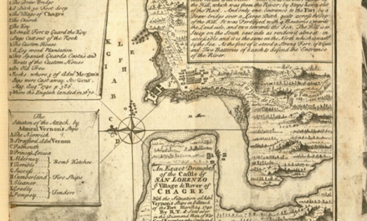
I picked up a volume to catalog that until recently was in the the Los Angeles County Law Library. We acquired it at auction in London in the spring 2014. The title is De mercatura decisiones, et tractatus varii et di rebus ad eam pertinentibus, published in Cologne in 1622. The volume is about commercial law and contains some decisions of the commercial court in Genoa, as well as various other writings on commercial law. We don’t know how it came into the possession of the LA County Law Library. There is one unusual thing about this volume: our copy has laid in before the title page a map, 14 x 17 cm. Since the land mass looked a little like the shape of Africa, I still wasn’t too surprised. A little closer look, and I saw “to Panama 82 miles.” OK, now I’m interested. I searched the map and found that the Library of Congress has a copy of this map in their Panama Canal collection. The catalog record is beautiful, and it indicates that the reason for the map was the bombardment of Fort San Lorenzo, Panama, in 1740.
Here’s my question. Why did the former owner of this copy of a book on commercial law published in 1622, find it useful to bind in a map of Panama, published in 1740?
– SUSAN KARPUK, Rare Books Cataloger

